This railway ran from Paisley West station in Maxwellton Street (also on the Canal line) to Barrhead Central. The line went round the back of Meikleriggs cricket ground, across Corsebar Road, beneath Stanely Road to the strip of land between Bushes Avenue and Stanely Drive, behind the houses on the south side of Falside Road then to the former Cadbury's depot (now houses) on Neilston Road and the adjacent Potterhill station.
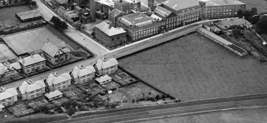
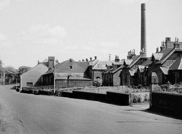
In the 1950's, a coal train ran mid morning, usually about eight to ten wagons . One or two days a week it continued beyond Potterhill to Glenfield and came back an hour or so later. After the coal depot closed Cadburys built their distribution depot on the site . Potterhill Station opened on 1 June 1886 and closed on 1 January 1917, services between Barrhead and Potterhill having ended in 1913. Freight traffic continued to Cadburys until 1970.
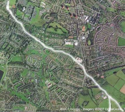
Picture 1 above - Google Satellite - Potterhill line (line of trees). From meikleriggs/ferguslie cricket ground (top left) to Gleniffer siding (bottom right).
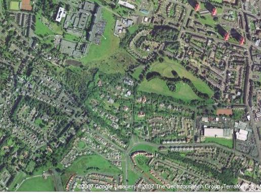
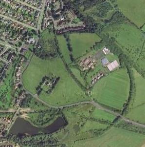
Picture 2 - Google Satellite - Potterhill branch (line of trees) curves from top left - meikleriggs/ferguslie cricket ground - to bottom right - Potterhill station (private house) next to Cadbury's factory (recently demolished). There is a break at Falside Road / Park Road junction. It originates at Paisley West station and ends at Barrhead Central.
Picture 3 - Google Satellite - the Potterhill line curving in to its Gleniffer depot (not to be confused with Glenfield station on the Paisley and Barrhead District Railway which can be seen at the other side of the reservoir at the bottom left of the picture)
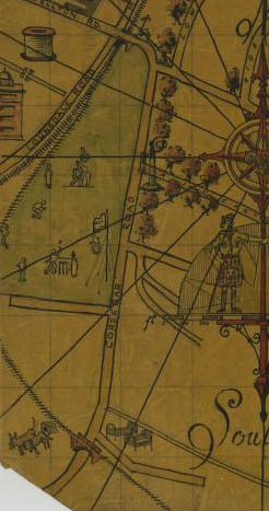
Picture 4 - The area with the railway can be seen in a 1931 scout map , the split with the Canal line is visible as is the curve round the cricket ground and the bridge crossing Corsebar Road.
The
photographs below are of Coresbar Junction which connected the Canal Line to
the Potterhill Branch.


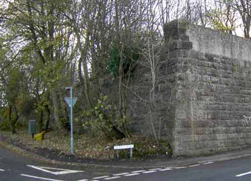
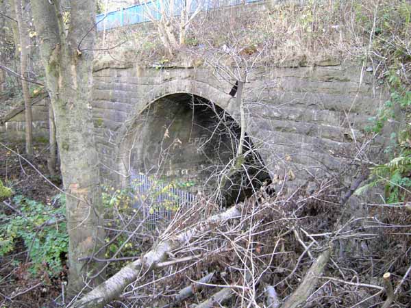
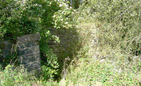
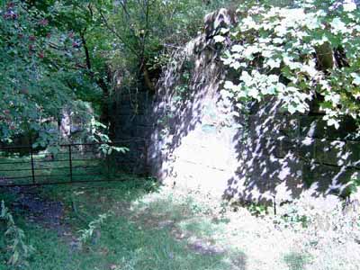
Below are the remains of a bridge at the junction of Coresbar Road and Victoria Road near the RAH hospital. The second photo is a short tunnel under Stanely Road near Corsebar Drive, the road is still used today. The other side is very deep and the blue metal safety railing can be seen in the photograph.
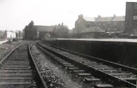
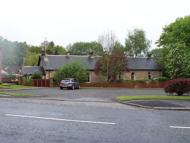
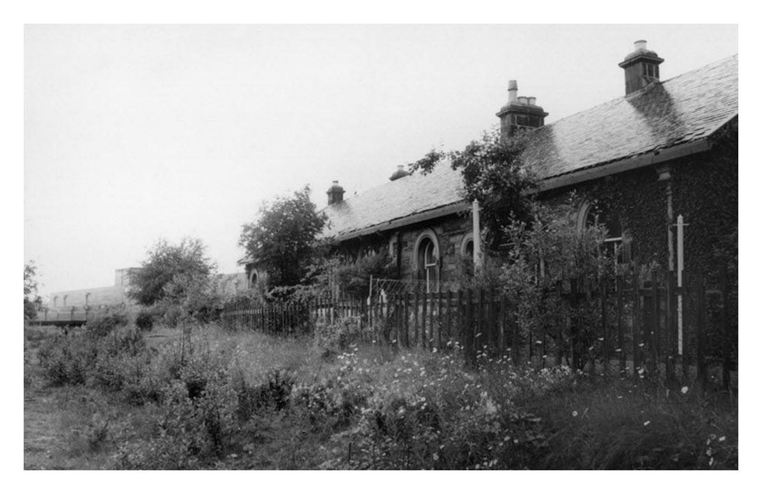
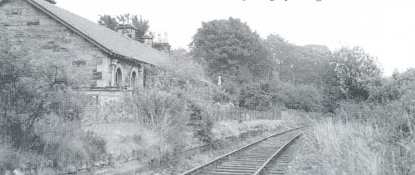
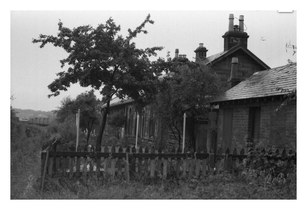
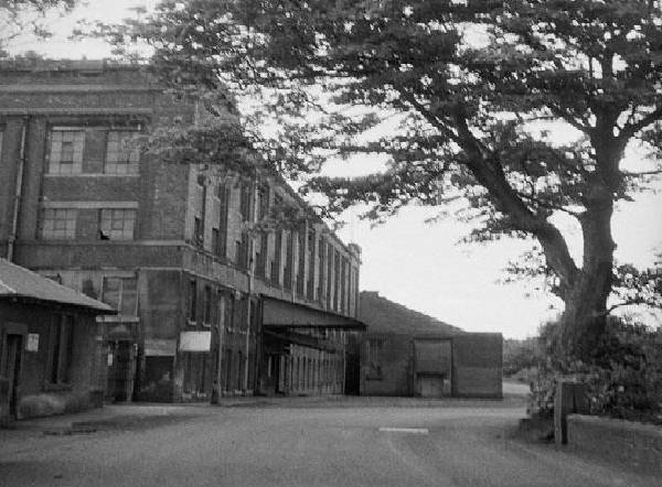
Potterhill Station
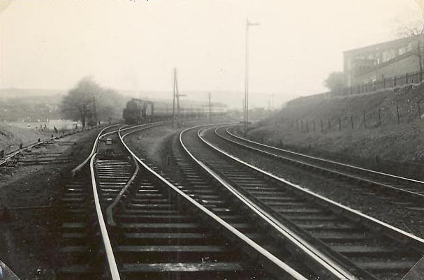
Below is Potterhill station in 1955 and secondly in 2006. It can be easily
seen from Neilston Road and is still very recognisable as a station and has
the address "Potterhill Station" ! It is now occupied by a business.
The railway goes under Neilston Road at the top of the hill at Thornley Park
Avenue. The first few feet have been filled in but beyond there is a very
steep drop . The left hand photograph shows the bridge on the other other
side of Neilston Road opposite Thornley Park Avenue, the ground there has
been filled in up to the level of the bridge.
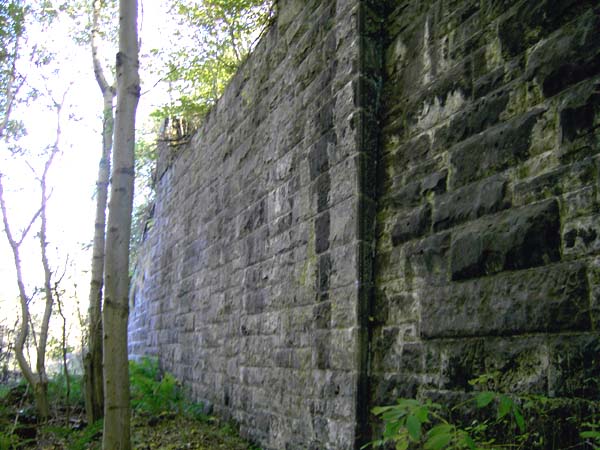
There
is a large stone bridge perhaps 50 feet high close to the bottom of Stoney
Brae at the end and to the right of the culdesac of new houses. Apparently
scouts used it for absailing at one time.
The track can be
followed further south in the fields between Caplethill Road at Brownside
Farm (opposite the university halls of residence) and the new estate at
Newburgh Drive, formerly the site of Fulton's Glenfield works. This works
was founded in the 1820s as a bleachworks, and largely rebuilt in 1879 and
later. It was latterly owned by William Fulton & Sons Ltd, scourers, dyers
and finishers, who used soft water from the Gleniffer Braes in their
processing.
There is at least one very deep natural ravine as well as the railway
bridges and cuttings in the area so it pays to be cautious.A new tarmac path
has recently been built from Glenfield Road past the bridge in the left hand
picture below so it's easy to find.
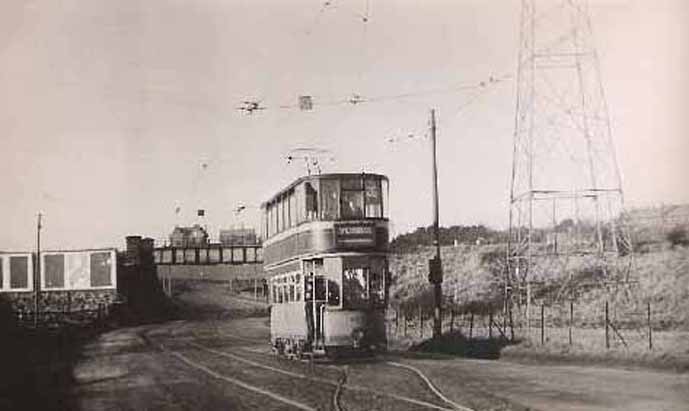
Glasgow tram on Route 28 (Renfrew Ferry to Spiersbridge via Barrhead)
taken on single track section in Caplethill Road. The line into the
Gleniffer depot over the bridge is behind the tram.
Barrhead Central Station, it was demolished
in the early 1950s